Cordillera Mountains
When talking about the majestic mountain systems of the planet, one of the first names that comes to mind is this one – the Cordillera. This is not just a single ridge, but an entire chain of mighty mountain structures stretching across continents, shaping the landscapes, climate, and history of vast territories. Their cliffs preserve millions of years of geological history, and their peaks, capped with eternal snow, break altitude records in their regions. Exploring the Cordillera is a journey through time and space, revealing just how diverse and impressive nature can be.
The name itself comes from the Spanish word “cordillera”, which means “mountain range” or “chain”. However, the scale it signifies is far more grandiose. This system is home to incredible biodiversity, thousands of unique species of flora and fauna, and numerous cultures that have adapted their lives to the harsh yet beautiful conditions of the high mountains. From the Arctic deserts of Alaska to the rainforests of Tierra del Fuego, the Cordillera showcases the full spectrum of natural zones on the planet.
Where are the Cordillera Mountains located?
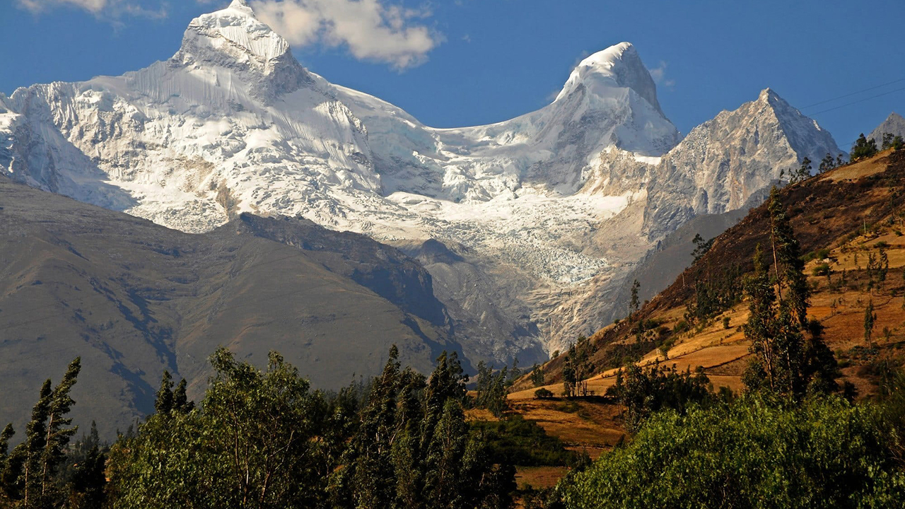
Finding the Cordillera on a world map is a fascinating experience, as they occupy a significant portion of the Western Hemisphere. Their location can be described as a gigantic geographic spine stretching along the western coast of both Americas. If you imagine North and South America as figures standing side by side, the Cordillera would resemble their powerful, curved backbone, supporting the bodies of the continents. It is one of the longest mountain ranges on the planet, unrivaled in the Western Hemisphere in terms of length and height.
These mountains form a climatic barrier that determines the weather over vast areas. They trap moist air masses from the oceans, creating humid western slopes and arid eastern foothills. Thus, from Alaska to Chile, the landscapes on either side of the ranges differ dramatically. This feature makes the Cordillera not only a physical but also an ecological boundary, on which the life of many ecosystems depends.
Cordillera on the map
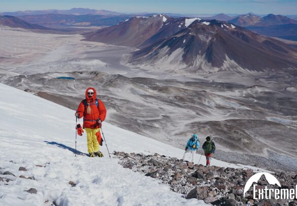
A closer look at the map reveals that the Cordillera is not a monolith. In North America, they are known collectively as the “North American Cordillera,” or more commonly, simply as the “Cordillera.” They begin in northern Alaska, extend through Canada, where they form the picturesque Coast Ranges and Rocky Mountains, and then enter the United States. It is here, in Colorado, that the famous Great Divide, where numerous ranges converge, is located. Many tourists plan a trip to North America specifically to experience these iconic landscapes, which include national parks such as Yosemite, Banff, and Yellowstone.
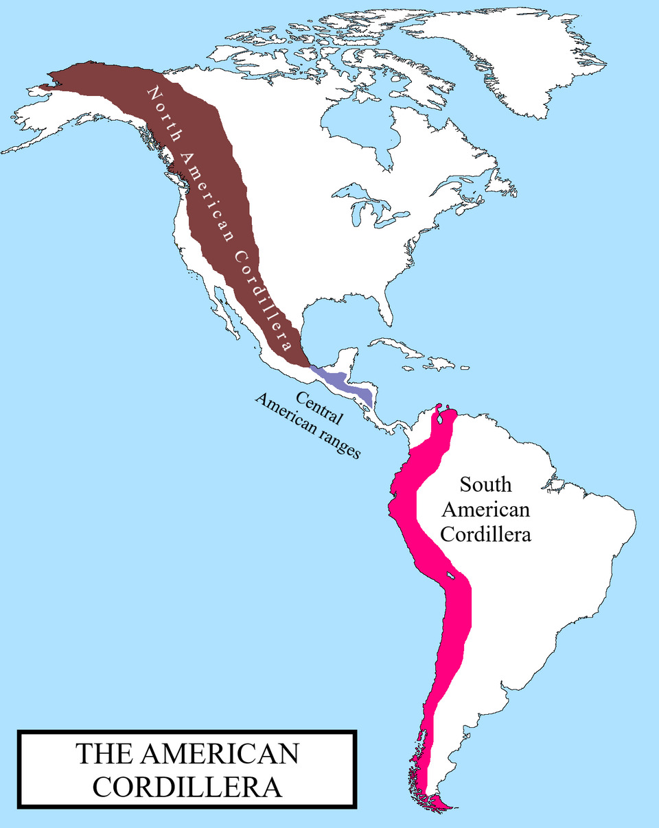
In Mexico, the system continues through the Mexican Plateau and the Sierra Madre, then forks. One branch runs through Central America, forming a narrow but high mountain range connecting the continents. The other descends into the ocean, only to resurface in South America as the mighty Andes. Thus, on a map, the Cordillera appears as a broken but clearly defined line that follows the western coasts of the continents almost seamlessly.
The highest point of the Cordillera massif
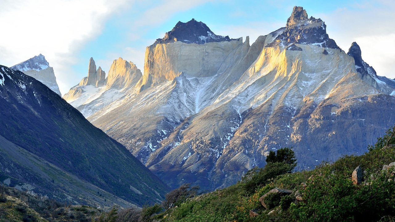
The question of the highest point of this grand system has a fairly clear answer when it comes to the classic American Cordillera. But interestingly, the absolute record belongs to a peak located in the Southern Hemisphere. At the same time, if we consider the entire system from Alaska to Tierra del Fuego as a single entity, the highest point undoubtedly belongs to a mountain that has long attracted climbers from all over the world with its grandeur and challenge.
This peak not only rises above all its surroundings but is also the highest point in the entire Western and Southern Hemispheres. Its snow cap can be seen from afar, and climbing it requires serious preparation due to the altitude and unpredictable weather conditions. This mountain is a symbol of the power of the Andes and the entire continent.


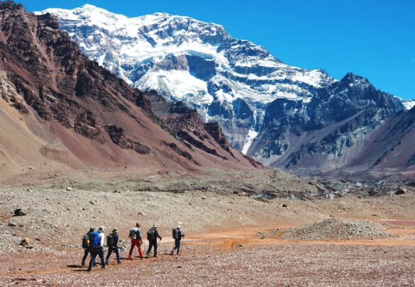
The highest peak in the Cordillera, and therefore in all of America, is Aconcagua. This 6,962-meter-high rock giant is located in the Argentine province of Mendoza, near the border with Chile. Aconcagua is part of the main Andes range and is also the highest peak outside of Asia. The mountain is of volcanic origin, although it is considered a dormant volcano rather than an active one. Its slopes are relatively gentle on the north side, making technical climbing accessible to experienced trekkers. However, the main danger is altitude sickness due to the extreme altitude.
Focusing on the northern part of the system, the undisputed leader is Denali (Mt. McKinley), at 6,190 meters. This majestic mountain, rising in central Alaska, is the highest point in North America. Unlike Aconcagua, Denali has a significantly colder climate and more technically challenging routes, as it is located closer to the North Pole. Its relief is astounding: from base to summit, the vertical drop is over 5,500 meters, greater than that of Everest. This makes Denali one of the most impressive mountain ranges in the world, a destination for many North American mountaineering tours.
Thus, the Cordillera not only shapes the landscape but also sets geographic landmarks, setting altitude records for entire continents. These two giant peaks, Aconcagua and Denali, serve as striking poles of a single system, demonstrating the diversity of its climatic zones and geological character.
Other peaks of the massif
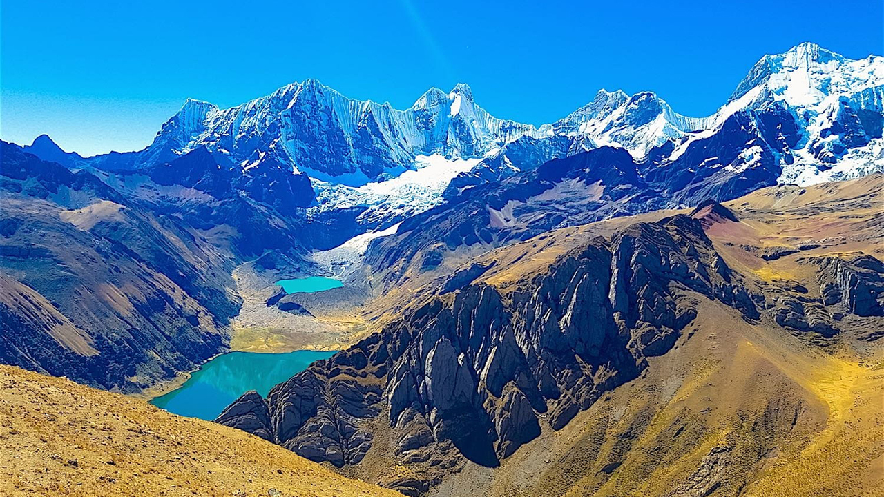
Between the two dominant giants, Aconcagua and Denali, stretches an incredible chain of other high and iconic peaks, each with its own unique place in the Cordillera’s terrain. Although not as tall as the absolute record-holders, these mountains often play a key role in shaping the local ecosystems, culture, and mountaineering traditions of their regions.
These peaks can be striking in their perfectly conical shape, be active volcanic centers, or be renowned for the extreme technical difficulty of their climbs. Many are national symbols of their countries, and their slopes have become natural laboratories for studying altitudinal zonation and the adaptation of plants and animals to harsh conditions.
The most famous and significant peaks, in addition to the leaders in height, include:
- Orizaba is Mexico’s highest peak (5,636 m). This stratovolcano attracts both climbers and scientists. Climbing Orizaba is considered one of the most popular high-altitude routes in North America, as it is the highest point in the region between Denali in Alaska and the volcanoes of Colombia.
- Mount Logan is Canada’s highest mountain (5,959 m), located in the Yukon Territory. It is the second-highest peak in North America after Denali.
Each of these peaks tells its own unique story about the power of nature that shapes our world. They are integral elements of the complex mosaic of the Cordillera, where glacial caps coexist with volcanic ash, and rocky walls with high-altitude meadows. Together, they create the inimitable image of a mighty mountain belt that stretches across both American continents.
North and South America with Extreme Guide
 Mexico
Dates:
March 14 – March 23
March 14 – March 30
Complexity:
Duration:
Height:
4.9 (27)
Left: 8 places
 Argentina
Dates:
January 24 – February 16
Complexity:
Duration:
Height:
Left: 8 places
 Ecuador
Dates:
December 27 – January 7
December 27 – January 11
January 31 – February 11
January 31 – February 15
Complexity:
Duration:
Height:
5.0 (82)
Left: 8 places
 Chile
ChileDates:
January 9 – January 22
January 24 – February 6
Complexity:
Duration:
Height:
Left: 8 places
 Argentina
Dates:
January 31 – February 16
Complexity:
Duration:
Height:
Left: 6 places
 Bolivia
Dates:
Complexity:
Duration:
Height:
 Argentina
Dates:
Complexity:
Duration:
Height: